If you’re staying in or near Sedona and are interested in hikes, then you’re indeed reading the right space. Here we have got for you all the best hikes in Sedona that you can try out!
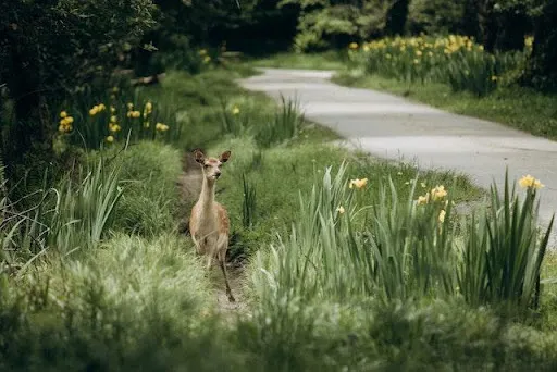
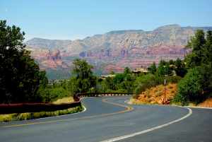
Sedona is a desert town located near Flagstaff. The area is surrounded by pine forests, steep canyon walls, and red rock buttes.
This hiking trail is mainly for people who are new to hiking and want to spend some time walking and admiring the beautiful pine trees and red rocks. However, there are some rigid walls on this trail which is difficult to hike for beginners.
Also, other than the splendid view, some of the highlights on the trail include wildlife, rivers, natural bridge, vortexes, and streams. It is 4,300 ft above the ground, and the weather is very pleasant all around the year. The weather is comparatively soothing, unlike Tucson or Phoenix trails.
So, let us check out all the best hikes and much more in the sections below!
Table of Contents
5 Best Hikes in Sedona
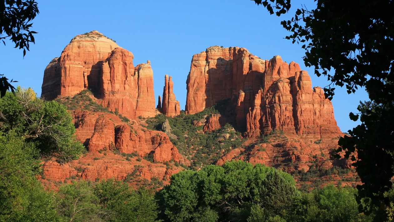
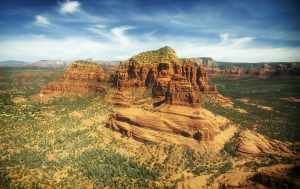
#1 Cathedral Rock Hike
The trail starts from the Back O’ Beyond Road. It is a short trail as it is only 1 mile long. First, you will find the junction between this trail and the Easy Breezy Trail, and a creek before you start your climb.
Furthermore, the initial ascent is very easy as it is a clear road and sometimes a few staircases made of rocks. There are also basket cairns which help you to know where to go.
Before reaching the junction between the Cathedral Rock and Templeton Trail, you will reach a plateau region. The view of Sedona from this plateau is incredible.
Now there will be some rocky sections, and you will reach the base of a cleft or crack in the rocks. Most people stop at this point and go back.
However, this cleft rises at an almost 45-degree angle for nearly 40 feet if you want to proceed. If you have gone to a lot of hiking trails, then you should climb this. However, beginners and people who are afraid of height should skip this part of the Cathedral Rock Trail.
Facts about the Cathedral Rock Trail
- Length: One mile
- Difficulty: Moderate but has some difficult parts
- Time to go to the top: 60 to 90 minutes
- Best time to visit: From November to March
- Accessibility: Has paved parking
- Elevation gain: About 600 – 640 feet
- Best time of the day to go: Evening around sunset
- Cost: $5 for parking
#2 Boynton Canyon Trail
One of the best hikes in Sedona, you will walk through a deep canyon and find ancient Indian ruins. You will see different types of trees during the hike, amazing views of canyons. Also, at the start of the Boynton Canyon has an energy vortex.
Furthermore, the first ¾ part of the journey is in open sky and is parallel to the Enchantment Resort. Hence, if you want to grab something to drink or eat, this is the perfect place.
After this section, there are a lot of small trees and bushes. Then you will find big pine trees that will provide sufficient shade. In the final part, it rises at the end of a canyon. From here, you can see a nice view of the bottom of the canyon. Also, most of the trail is on level ground. However, there are few elevations gain.
If you only want to see the vortex, then it is near the start. You need to go to the side trail known as Boynton Vista Trail. It is ½ a mile and is situated at the base of the rock spire. From here, you can see a clear of the Courthouse Butte, Deadman’s Pass, and Mescal Mountain.
Facts about the Boynton Canyon Trail
- Length: 6.1 mile
- Difficulty: Easy to Moderate
- Time to go to the top: 2.5 hours
- Best time to visit: All round the year
- Elevation gain: About 650 feet
#3 Bear Mountain Trail
This trail is for people who are experienced and do not mind the elevation. It is 4.3 miles long, but the height is 1,975 ft above ground level. You will get an amazing view from the top that includes the ghost town of Jerome, snow-covered mountain peaks of San Francisco, the Mogollon Rim, Doe Mountain, and Courthouse Butte.
Facts about the Bear Mountain Trail
- Length: 4.3 miles
- Difficulty: Hard
- Time to go to the top: 5 hours
- Best time to visit: From April to November
- Elevation gain: About 605 feet
#4 Doe Mountain Trail
Doe Mountain Trail is one of the best hikes in Sedona as it has a magnificent view and solitude with an exclusive chance to roam around on the top of the mesa.
It is an out-and-back trail, and the path is very steady, which gradually ascends. The top of the mountain is flat, and the overall climb is very easy. At the top, the trail goes from one end of a mesa to another one.
Furthermore, the top of the mountain very quiet and peaceful as very less animal is present there. However, you can see some rabbits and birds.
Also, you will get a 360-degree view, and some of the famous landmarks you can see are Bear Mountain, Courthouse Butte, Mescal Mountain, and Fay Canyon. You can see all of them clearly at the southwestern end of a mesa, the trail’s end.
Facts about the Doe Mountain Trail
- Length: 2.5 miles if you want to climb the whole trail at the top of Doe Mountain.
- Elevation: about 425 – 430 feet
- Difficulty: Easy to moderate
- Time to go to the top: 90 – 120 minutes
- Best time of the day to go: During Sunrise or sunset
- Pass Required: Red Rock pass is needed.
- Parking: Available. But the space is really small, and it is also shared with the Bear Mountain Trail.
#5 Devil’s Bridge Trail
The most visited trail in the region is Devil’s Bridge Trail, and it is very easy to climb the trail. It is an out-and-back trail that will lead to a great natural arch made from sandstone. Now you might walk below the arch, and there is a stair beside it that will lead to the top.
Furthermore, the trail is a very busy place. Not only are there countless hikers but also ATVs, jeeps, cars, and mountain bikes. Almost half part of the trail is very easy to climb as it has a wide space. However, when you climb near the arch, it becomes steeper and narrower.
For the whole trail, there is no shade at all. You can bring your hat or umbrella to protect yourself from the harsh sun rays.
If you want to get a parking spot, you need to be very early, especially if you visit the trail on a holiday or weekend.
Facts about the Devil’s Bridge Trail
- Length: 4.2 miles
- Elevation: about 159 feet
- Difficulty: moderate to difficult
- Time to go to the top: 40 – 60 minutes
- Best time of the day to go: In the morning
Best Day Hikes Near Sedona
Soldier Pass Trail
The trail starts from the middle of the town and then goes directly towards the backcountry. The first half of the trail is very busy as there are many jeeps and other vehicles. You will see a signed trailhead after walking for few minutes. The trail is open from 8:00 am – 6:00 pm.
Also, after ¼ mile, the trail dips, and then its climbs out to Devils Kitchen. Now from here, the trail is on ground level for another ¼ mile, and you will reach the Seven Sacred Pools. After walking from here for another ½ mile, the path divides into two parts.
The right side of the trail is a steep walk for ¼ mile, where you will reach an arch. And from this point, you will see the mesmerizing view of the town.
If you want to continue to the main trail, then go to the left side. In this way, there are almost no trees; hence there is no shade. The road is very rocky and steep. After walking for 2 miles, you will be on the top of the Brins Mesa Trail.
Broken Arrow Trail
If you want to see the beautiful scenery of red rock, then you should visit the Broken Arrow Trail. There is no shade; hence it can be really hot in the summer months. Also, there is a trailhead which is located opposite the jeep road.
Furthermore, after walking for 200 feet, you will cross some ledge. This is at the bottom of the Battlement Mesa. Now walk for another 0.6 miles, and you see the Devil’s Dining Room, surrounded by a fence.
You will reach the Twin Buttes on the right side, and if you continue for another 1.5 miles, you will get the Chicken Point. There is a narrow side path on the right side of Chicken Point. Walk for 0.5 miles on this trail, and you will come across the Submarine Rock.
Courthouse Butte
You can visit the Courthouse Butte from two different directions. From the north side, you need to climb southeast for ¼ mile towards the Bell Rock. In this intersection, you can stay at Bell Rock or climb towards the east side of the Courthouse Butte.
If you are going from the southern side, there is a big Bell Rock Road from Kiosk. The pathway is not steep, and after 0.5 miles, you will see the signed trailhead of the Courthouse Butte.
Once you reach the top, you will get an amazing view of rock terraces and grassland.
Fay Canyon Trail
One of the best hikes in Sedona is the Fay Canyon Trail. The main attraction of this trail is the unique rock formation. Other than that, you will also see box canyons, red rocks, and canyon walls.
Furthermore, this trail has a variety of wildlife and greenery. It can get steep at some parts due to the old creek beds.
Once you reach the top, you can see the Fay Canyon Arch, a natural arch. From here you will get a great view of the surrounding mountains and cliffs.
Some other options are:
- Brins Mesa Trail
- West Fork of Oak Creek
- Boynton Canyon Trail
- Devil’s Bridge Trail
- Cathedral Rock Trail
- Bear Mountain
West Fork Trail Sedona
West Fork Trail is situated in the Oak Creek Canyon and is one of the best hikes in the Sedona region. This trail crosses the West Fork Creek many times, and every time you will see outstanding rock formations. These are naturally made due to the rushing water.
Furthermore, this trail is amazing for people who want to escape the hot weather as there are plenty of water, shade, and trees.
It is almost 7 miles long an elevation of 400 feet. Since it is an in-and-out trail, you can make the trail as long as you want. Moreover, the trailhead is situated 10 miles towards the north of Sedona.
There is also a parking space, but it fills very quickly, and you cannot park on the highway. So, it would be best if you reach the trail early.
Sedona View Trail
The views from the Sedona View Trail are one of the most beautiful views in this town. You will see the stunning views of Doe Mountain, Sugar Loaf, Oak Creek, Coffee Pot Rock, Wilson Mountain, and Chimney Rock.
To reach the top of the trail, you need to turn right and then turn left. You will get a gate and turn right to follow the trail. And from this part, the trail is steep, and there are many prickly cactus and juniper trees.
The trail ends at the Airport Loop Trail. If you want to visit this trail, then walk to the right side.
Best Hikes in Sedona with Water
Clarkdale Parsons Trail
It is a round trip hike which is about 8 miles. From the northern side, you will get a great view of the Red Rocks and Sycamore Canyon.
Rimrock Bell Trail
Another among the best hikes in Sedona is the Rimrock Bell Trail. It is about 3.3 miles, and along the trail, you will reach The Crack, a swimming hole. This place is called Wet Beaver Creek. From here, there is another 6.6 miles trail that will lead you to the Coconino Nation Forest.
Sedona Huckaby Trail
It is situated 1 mile up of Schnebly Hill from Route 179. After hiking for 2 miles, you will see the Wilson Mountain, Oak Creek, Midgley Bridge, Steamboat Rock, and the Red Rocks.
Quick Facts About the Best Hikes in Sedona
Top 6 Hikes in Sedona with Waterfall
- Soldier Pass Trail
- Grasshopper Point
- Schnebly Hill Road
- West Fork Trail
- Slide Rock State Park
- Honanki Ruins
Top 6 Best Hikes in Sedona for Families
- Baldwin Trail
- Devil’s Bridge Trail
- Fay Canyon Trail
- Sedona View Trail
- Huckaby Trail
- Red Rock Crossing
Sedona Hikes Easy
- Teacup Trail
- Airport Mesa
- Doe Mountain
- Chimney Rock Pass
- Little Sugarloaf
- Templeton Trail
Final Thoughts
We hope this article about the best hikes in Sedona helped you. No matter which hikes you choose to visit, make sure you carry a bottle of water and some dry snacks.
Most of these trails do not have any shades, so make sure you wear your sunscreen and carry a hat along with you.